
Making your ride along Mason more comfortable
Tessa Greegor, FC Bikes Program Manager, City of Fort Collins
When I first started with FC Bikes, nearly three years ago, one of the first projects I reviewed was the striping plan for Mason Street that would be implemented prior to the launch of MAX. The plans included shared lane markings (“sharrows”) between Laurel and Mountain, as they exist today. At the time, City staff explored the option
to provide dedicated bike lanes, but had concerns related to inconsistent bicycle facilities (a few blocks would not allow for bike lanes without removing parking) and how the proposed bike and transit mixing zones would work. The decision was to provide sharrows, and monitor the corridor.
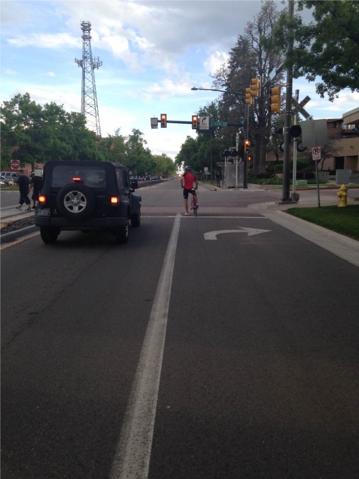
Figure 1: example of Mason St today
Fast forward nearly three years, and the need for dedicated bike lanes on Mason Street is clear. Over the past couple years, observations of near misses and frequent concerns and confusion from people bicycling, driving and operating transit, have clearly demonstrated that the current Mason Street configuration is not working well for anyone.
In the next month or two, the City will install a new striping plan for Mason St., one that was considered nearly three years ago, and one that is designed to work a little better for everyone. Bike lanes or buffered bike lanes will run the majority of the corridor, from Laurel St. to Cherry. Where intersections are constrained, bicyclists will share the right turn lane with MAX buses guided by sharrows and signs, a design that will accommodate the way people use the street today (see
figure 1). Crossing improvements are also planned for the intersection of Mason St. and Cherry, making a seamless connection to the Poudre River Trail.
Example Mason Street cross-section:
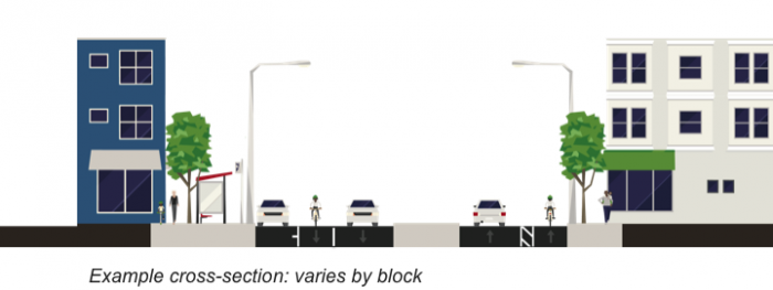
Figure 2: example cross-section (varies by block)
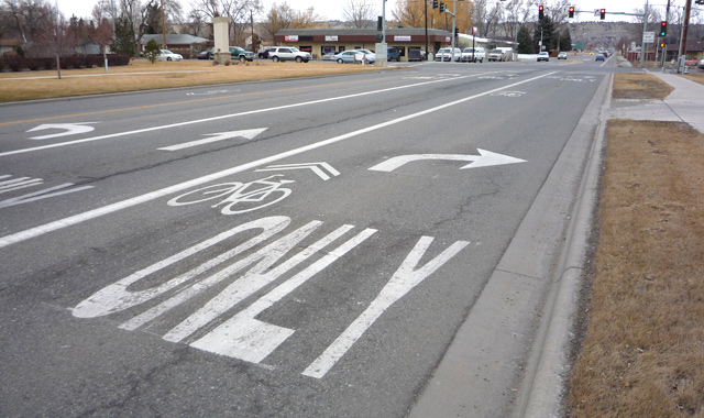
Figure 3: Mason Street Proposed Intersection Design
Without moving the curbs, the Mason Street corridor faces constraints. Street widths vary by block, and three blocks remain too narrow to fit bike lanes, parking and travel lanes. With high demand for both parking and bike lanes, tradeoffs over the loss of either remain an ongoing discussion. From an operational and safety standpoint, it is a priority of the City to complete bike lanes along the entire Mason Street corridor, however the project may likely be completed in phases to ensure parking impacts are adequately addressed.
Mason Street, the City’s first multimodal Enhanced Travel Corridor, was envisioned as an extension of the Mason Trail (terminates at Laurel St.) and a connection to the Poudre River Trail just north of Cherry. This important corridor now serves as a prominent bike share corridor, with check-out stations making it easier than ever to combine bicycling with transit. And with new bike lanes on the way, being able to take transit, jump on a bike, and ride along the Mason Corridor will make traveling without a car to destinations like downtown Fort Collins that much more comfortable and convenient.
Stay tuned for more information, or visit fcgov.com/MasonRestriping